


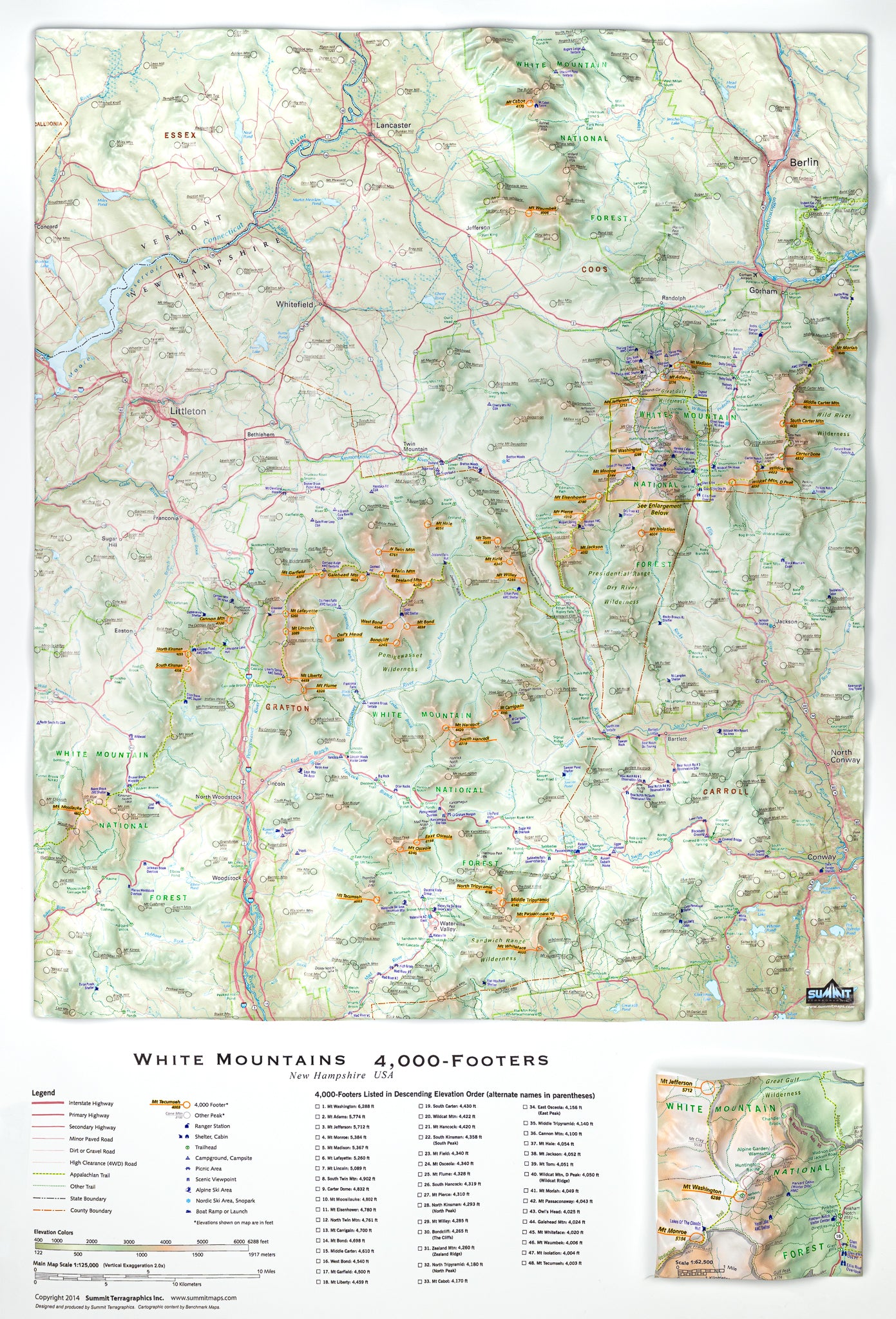


3D Wall Map of the New Hampshire 4,000-Footers
$64.00
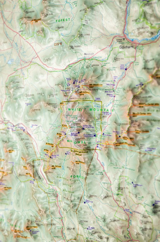
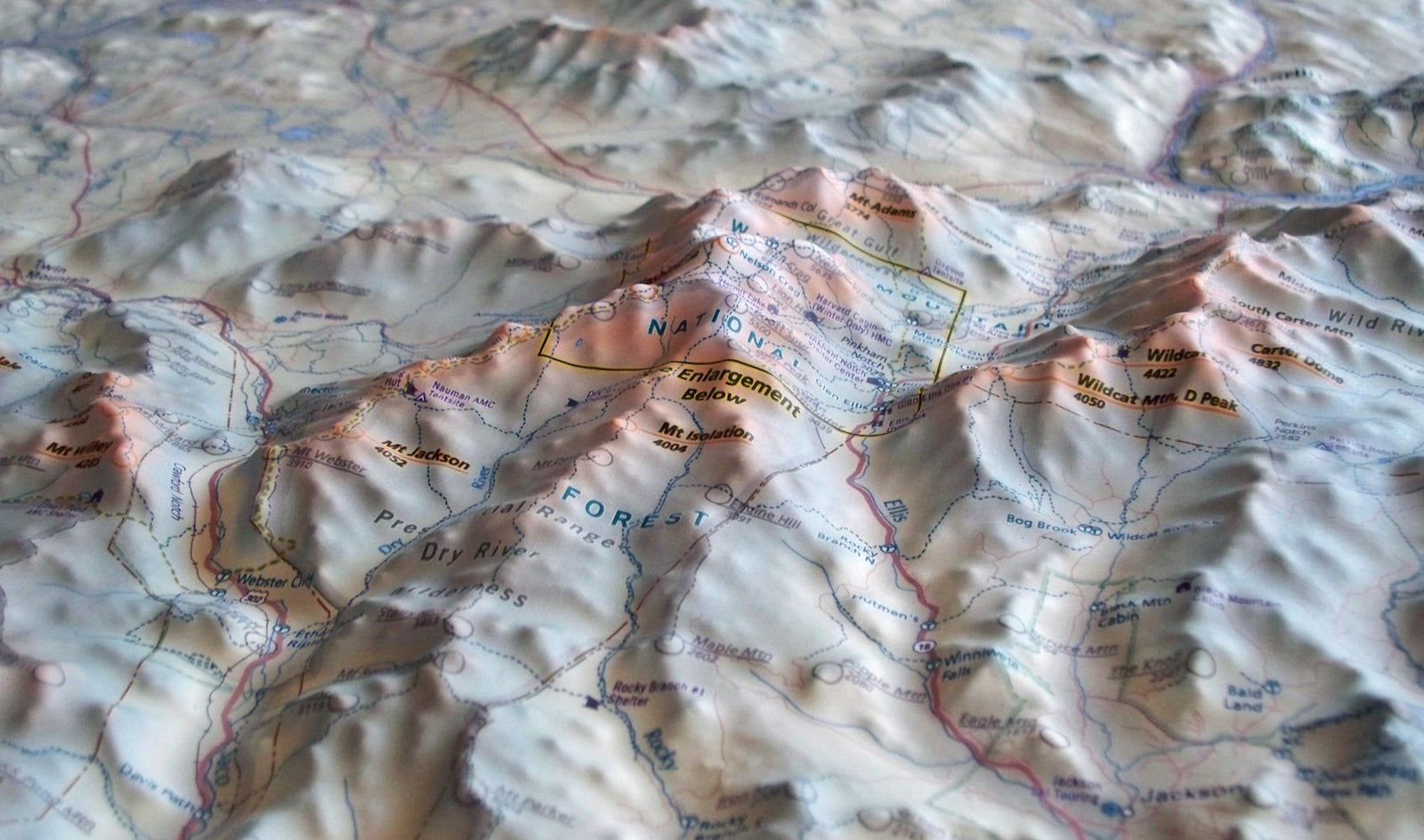
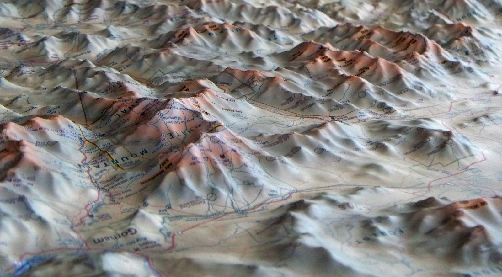
This raised relief wall map by Summit Terragraphics is the first three dimensional map of New Hampshire’s White Mountains produced in more than a century. Printed on durable plastic and thermoformed to match a detailed terrain model, it brings the landscape to life in precise 3D detail.
All 48 of the region’s iconic 4,000 footers are labeled, along with hundreds of additional peaks, trails, shelters, trailheads, and key geographic features. Roads, streams, ponds, and other landmarks complete this beautifully detailed map. Perfect for planning adventures or displaying your love for the White Mountains.
Product Info
- Size 32” x 22”
- Frame not included